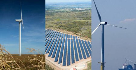
Finding suitable sites for renewable energy - Biodiversity sensitivity mapping
The global renewable energy transition is gathering pace. In offshore wind, annual additions are expected to triple by 2028 from 2023 levels, in line with the climate COP28 Global Renewables and Energy Efficiency pledge. This expansion must also align with the Global Biodiversity Framework's goal to halt and reverse biodiversity loss by 2030. As development proliferates, there is a clear need for timely and coordinated spatial planning that balances climate goals with the need to minimise impacts on people and biodiversity.
Many of the potential impacts of wind projects on biodiversity are well established, and as the offshore wind industry matures, they are increasingly understood. This includes the need to avoid sensitive marine and coastal habitats like seagrasses and corals, and to minimise bird and bat fatalities linked to collision with turbines and power lines. However, the available spatial biodiversity data to understand these risks is not evenly distributed globally. Rather, the information is biased to the better-studied locations.
To achieve climate and biodiversity goals, offshore wind will need to expand into many new areas, including emerging market countries where the available biodiversity information could be limited. In such areas, the most important areas for biodiversity might not yet have been identified, and we may not yet know which features are present or how they use the area. Hence, offshore wind development that is not properly planned could have significant negative implications for biodiversity conservation.
This can be tackled through sensitivity mapping.
What is sensitivity mapping?
Biodiversity sensitivity mapping uses existing spatial data to build a picture of the species and habitats that could be sensitive to development impacts. It can be done in conjunction with biodiversity risk screening, usually early on in the planning process. The process generally starts with publicly accessible and credible global and regional biodiversity datasets available through the Integrated Biodiversity Assessment Tool (IBAT). This can be supplemented with other online datasets, scientific literature, citizen science, and knowledge provided by individual experts. Local stakeholder input from people and organisations connected to the biodiversity in the mapping area is also essential.
The biodiversity features identified are then scored or categorised according to their sensitivity or susceptibility to impacts. This can be done using a range of criteria including conservation threat status (e.g., Critically Endangered species could be considered most sensitive to potential impacts), behaviour (e.g., species known to fly at turbine rotor height), legal requirements (e.g., national priority species lists), and stakeholder concern. The categories are used to create a colour-coded ‘heat map’ that indicates areas of higher versus lower biodiversity sensitivity. Planners can then use this information to guide where to explore offshore wind development with the lowest biodiversity impacts. In turn, this means that projects sited in lower risk areas should have fewer mitigation requirements and a much lower likelihood of requiring offsets.
Overall, robust spatial planning supports a nature-safe renewable energy transition, and cost-effective projects for developers.
How The Biodiversity Consultancy can help
We support government-level and developer-led sensitivity mapping for the onshore wind, offshore wind and solar sectors .
The Biodiversity Consultancy is especially experienced in supporting sensitivity mapping in emerging markets where the available biodiversity data are limited (especially offshore) and where we leverage our expertise and network to connect with specialists and data holders in the country. We have partnered with the World Bank’s Energy Sector Management Assistance Program (ESMAP) to produce guidance on environmental and social sensitivity mapping for offshore wind spatial planning , and have supported lenders in implementing the approach in several country contexts. We have also worked closely with the International Union for the Conservation of Nature to prepare a technical note on spatial planning (publication pending) explaining how sensitivity mapping and other tools contribute to successful sectoral plans.
We can help prioritise data gaps identified through the sensitivity mapping process and plan to address them strategically and cost-effectively. Our pragmatic landscape and seascape scale approach can be refined using relevant technical information if it is available, such as information on renewable energy resources or on-ground or seabed geotechnical suitability for wind installation. This means biodiversity sensitivity mapping can be focussed on the areas where development is most likely, with the associated time and resource savings.
Categories: Renewable Energy, Marine, Insight, Biodiversity Risk and Opportunity
Make Nature Your Business
Find out how you can make nature your business.


